The neighbourhood where pedestrians walk in the road
Twenty streets in northern Agios Ioannis with room for neither two passing cars nor a pushchair. Why it turned out this way — and what paint and signs alone could change.
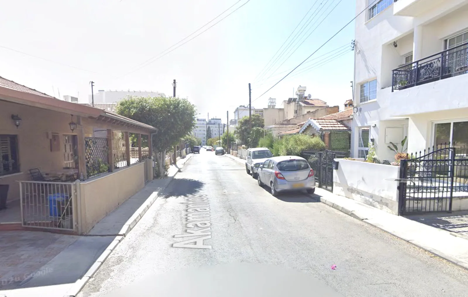
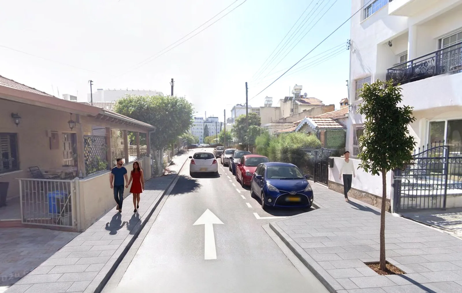
Akamantos street. Drag the slider: on the right is how it is today, on the left is what fits into exactly the same space if you divide it differently. Not a single wall moves.
Visualisation: cy4people. Base image: Google Street View, October 2024On a map this neighbourhood looks ideal. A dense grid of short streets, two- and three-storey houses, a school, a church, corner shops. Twenty minutes on foot to the old port, fifteen to the sea. This is precisely how a Mediterranean town should be built.
Now try walking through it with a pushchair.
Where this is
We are talking about the northern part of the Agios Ioannis parish, postcode Lemesos 3016. The neighbourhood is wedged between Archbishop Makarios III Avenue, Markoni street and Misiaouli kai Kavazoglou — roughly halfway between the old centre and the northern suburbs. It is neither a periphery nor a historic quarter: an ordinary residential area, one of dozens in Limassol.
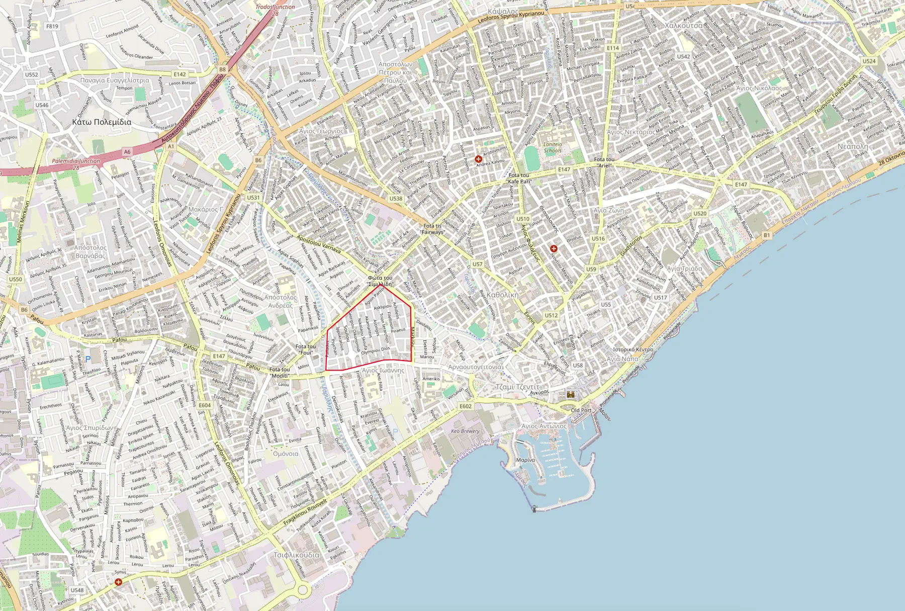
The neighbourhood at city scale. About a kilometre and a half to the seafront, two to the old port.
Base map: OpenStreetMap, ODbL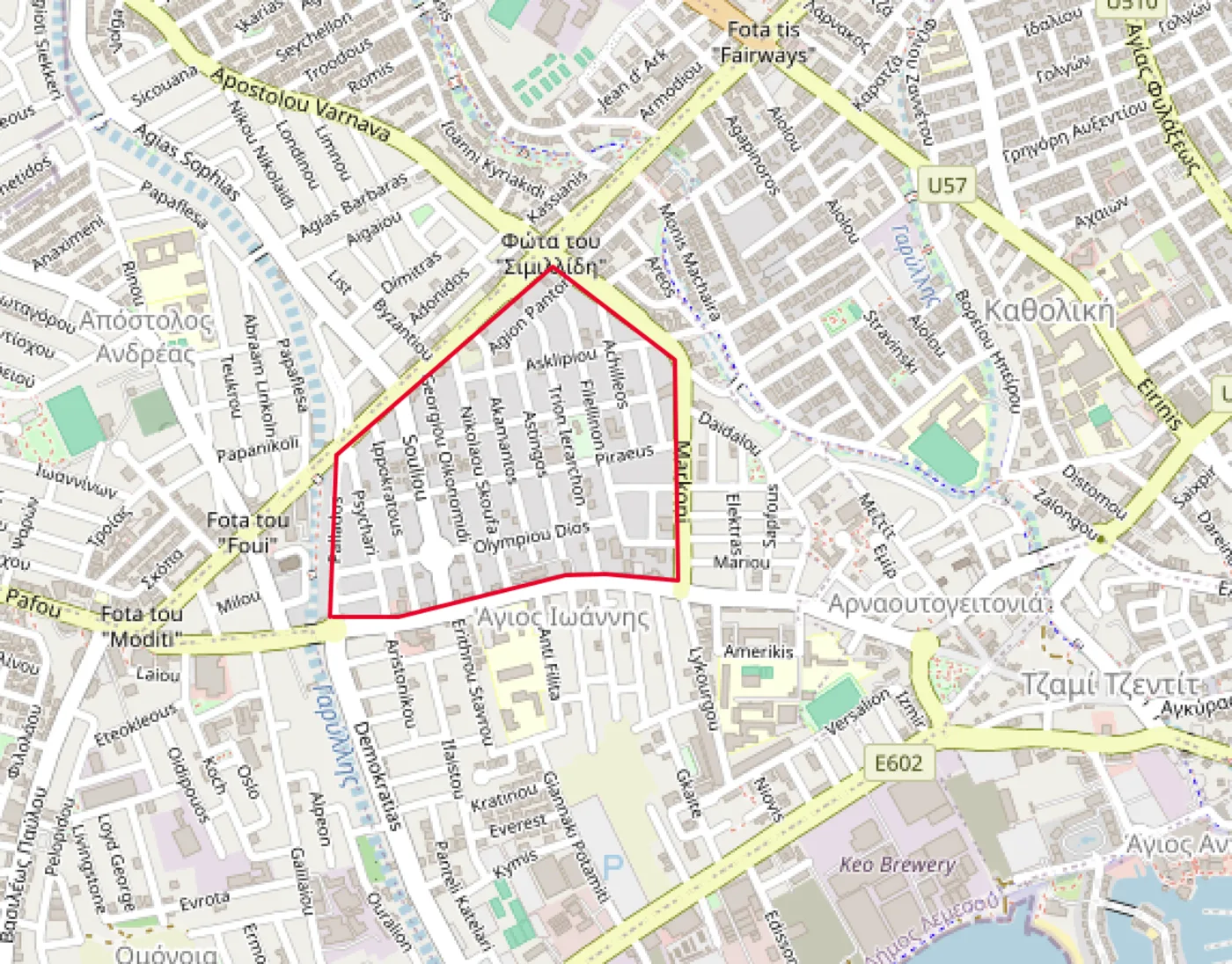
Twenty streets inside the outline. Akamantos, Mouson, Astiggos, Asklipiou, Achilleos, Trion Ierarchon, Piraeus, Nikolaou Skoufa, Georgiou Oikonomou, Ippokratous, Souliou, Psychari, Olympiou Dios and others. Almost all of them are two-way on paper.
Base map: OpenStreetMap, ODbLEight metres for everyone
Here is Akamantos street. Google Street View — nothing cherry-picked, just an ordinary day.
Akamantos street, looking north. Cars stand along the kerb, squeezing the carriageway down to a single lane. As a continuous surface, the pavement simply does not exist here.
Google Street View, October 2024And this is not one unlucky street — the whole neighbourhood looks like this.
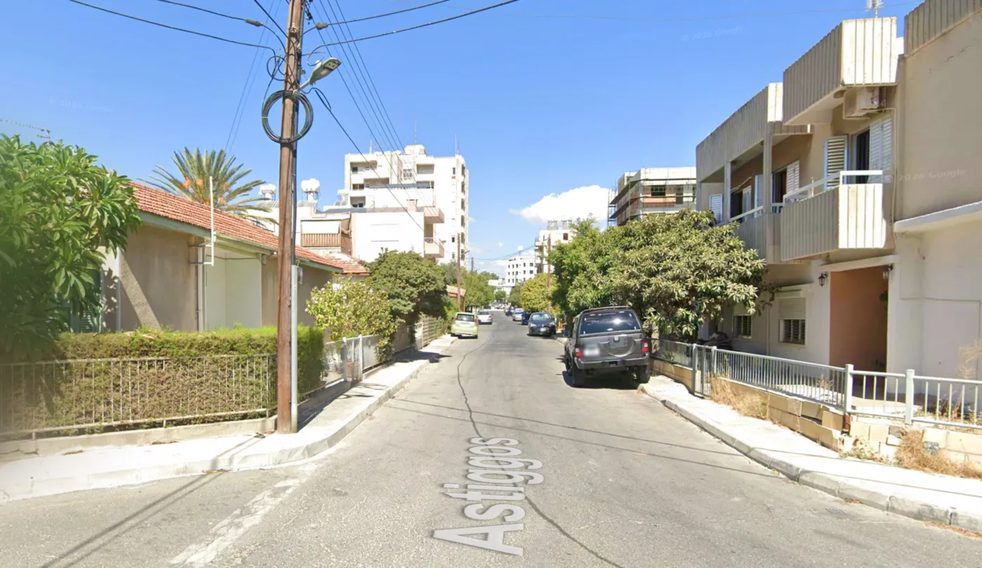
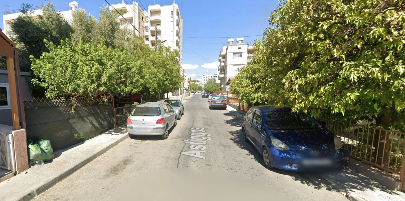
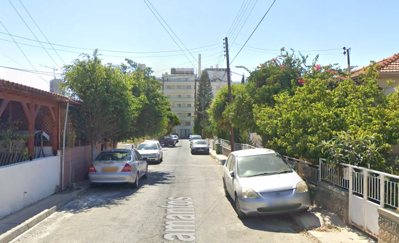
Images: Google Street View
Let us add up what has to fit between the walls. Two traffic lanes — 5–6 metres at the very least. Parking along one side — another 2 metres. Two pavements of 1.5 metres — another 3. About 11 metres in total.
What there is — eight.
Eight metres cannot be divided into eleven. Something has to go — and it is always the same thing: the pavement. The car parks half on the kerb, because otherwise oncoming traffic cannot pass. The pedestrian steps into the road, because otherwise there is no way through. The wheelchair user does not leave the house at all.
This is not about bad drivers
It is tempting to blame driving culture: fine people harder, tow more often, run a social media campaign. The problem is that in physical terms there is nothing to fine. A driver who has arrived home has nowhere to leave the car except the pavement — there are no marked bays on the street, and far from every house has a yard.
As long as the rules say “two-way traffic”, the geometry says “there is only room for one thing”. Geometry always wins that argument. The only way to get the pavement back is to first admit that the street is single-lane, and then divide what is left honestly.
The fix: pick one direction
The idea is simple. Make the streets officially one-way, alternating directions, and give the metre and a half you free up to pavements and marked parking.
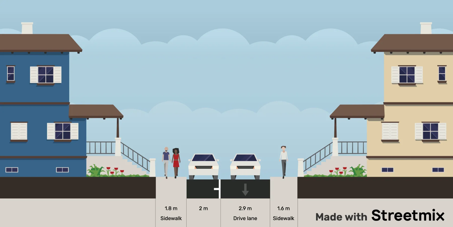
The same section, divided again. A 1.8 m footway + a 2 m parking bay + a single 2.9 m lane
- a 1.6 m footway. The same 8.3 metres — except now you can walk on both sides, and cars stand in their own space rather than someone else’s.
The 2.9-metre lane is a deliberate decision, not a saving. A narrow lane physically forces slow driving: getting to 60 km/h on it feels wrong even without cameras. That is cheaper and more reliable than any sign.
The next step is to connect the streets so that cutting through the neighbourhood stops being worthwhile, while every house stays reachable by car.
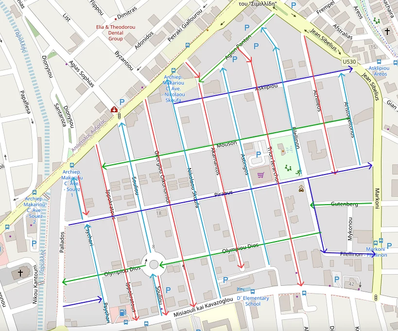
Direction plan. Neighbouring streets point opposite ways. Every house is reachable; driving straight through the neighbourhood is not — the route pushes you back out onto Makariou or Markoni. Through traffic returns to the arterials it belongs on.
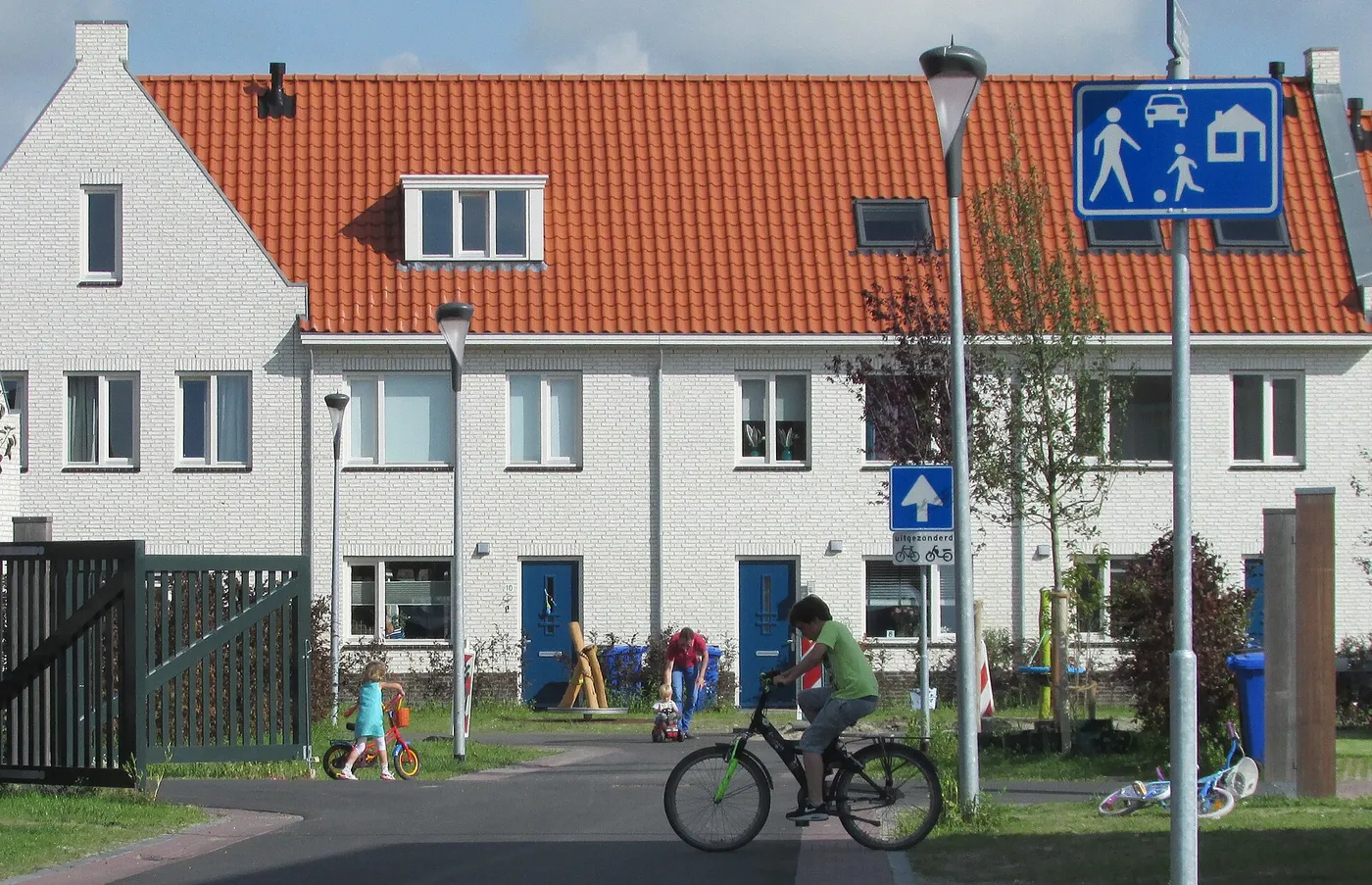
Diagram: cy4people, base map — OpenStreetMap, ODbLOne detail without which the whole thing breaks: cyclists must be allowed to ride both ways. In the Netherlands and Belgium this is standard — a small “except bicycles” plate under the one-way sign.6 Otherwise one-way working lengthens cycle routes and pushes people out onto main roads.
What it could look like
Nothing is demolished, no building line moves, houses and walls stay where they are. Only the way the existing space is marked out changes.
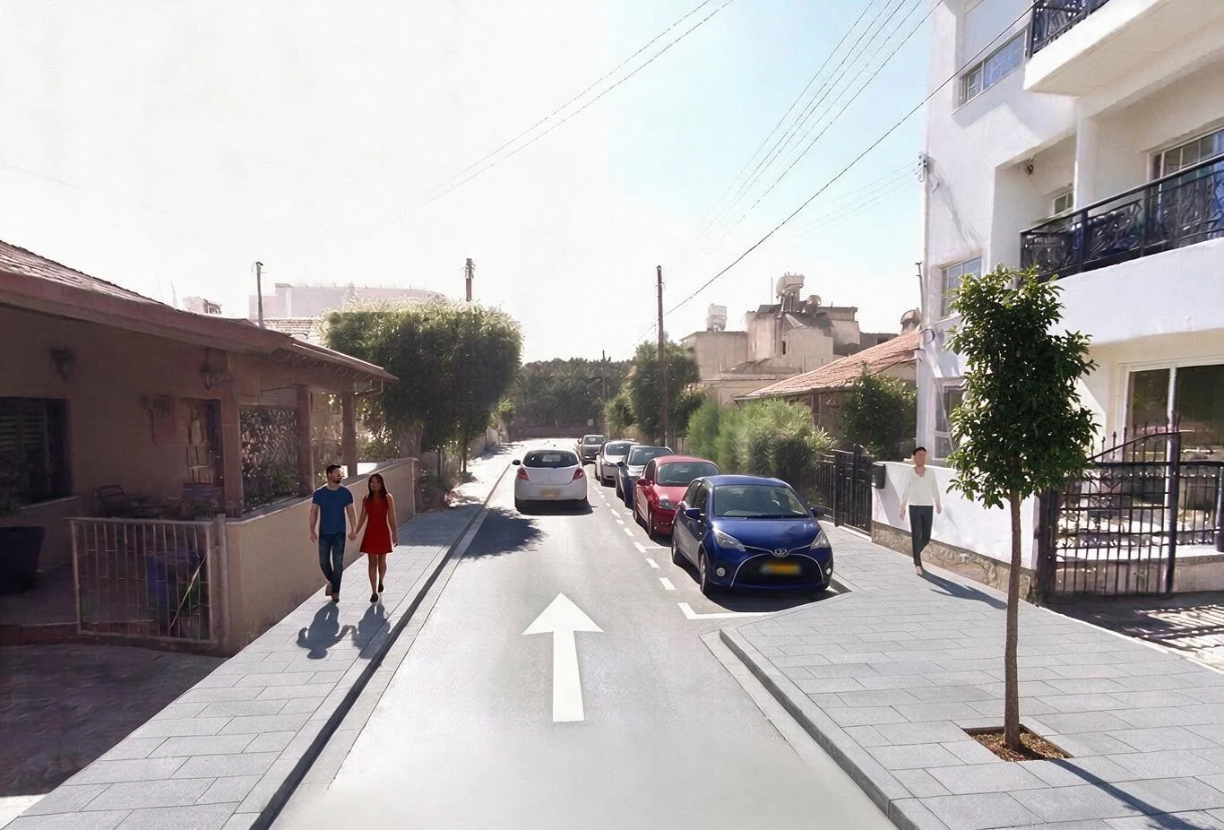
Akamantos after the redesign. The pavement is continuous on both sides, cars are tucked into a marked bay, and there is one lane with an arrow on it.
Visualisation: cy4people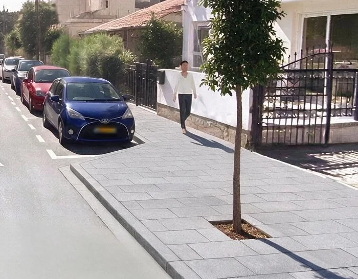
Three things that are missing today: a raised kerb, a marked parking bay that gives cars no reason to climb onto the paving, and a tree pit set into the footway itself.
Visualisation: cy4peopleThis has been done before
None of this is experimental. The pattern — break the area into cells, remove through traffic, hand the freed space to people — has been running in Europe for nearly half a century, and the results have been measured repeatedly.
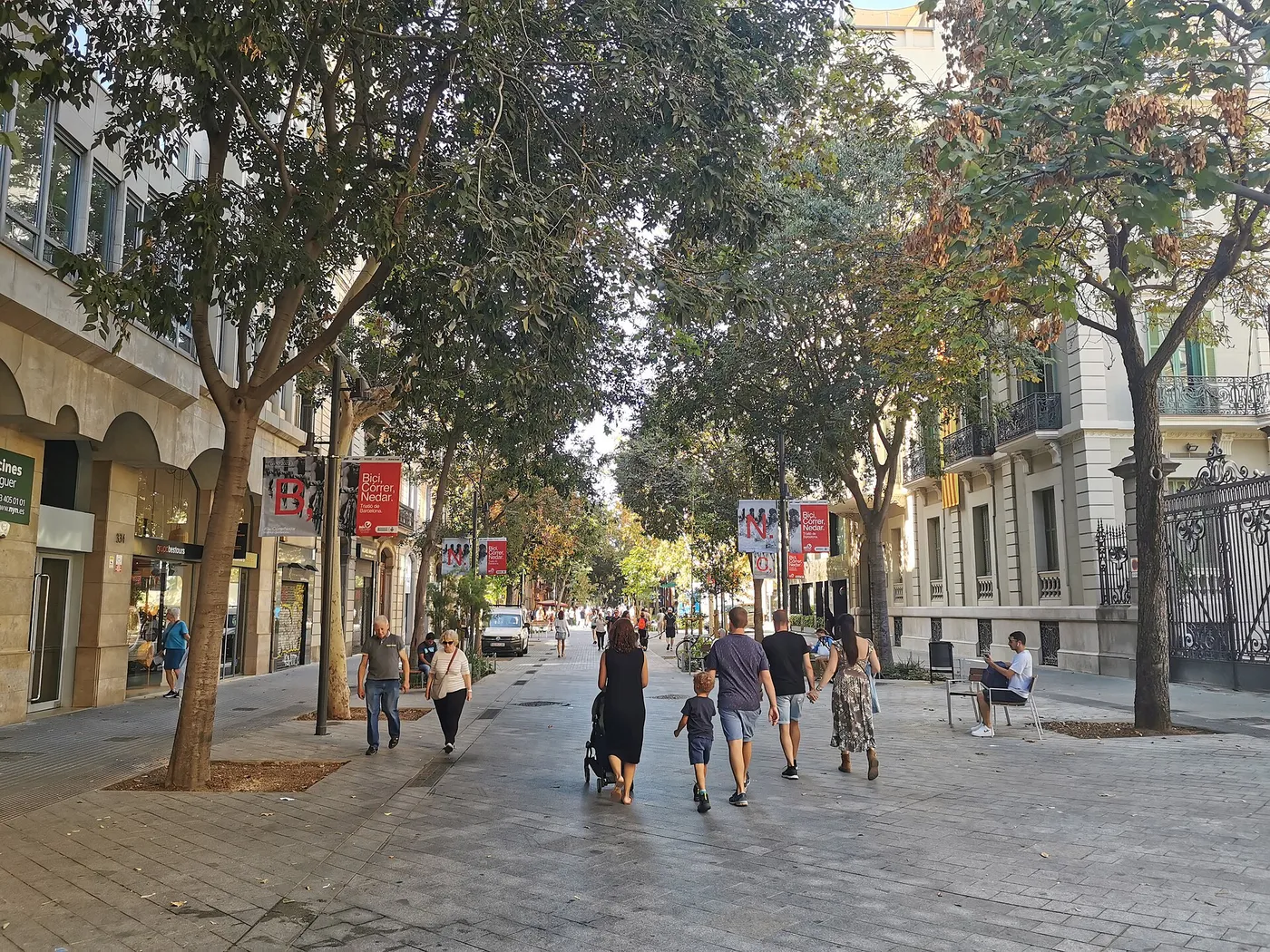
Consell de Cent, Barcelona. This street had two lanes in each direction plus parking. Now it has one service lane and everything else belongs to people. Same asphalt, different priorities marked on it.
Photo: Cataleirxs, Wikimedia Commons, CC BY-SA 4.0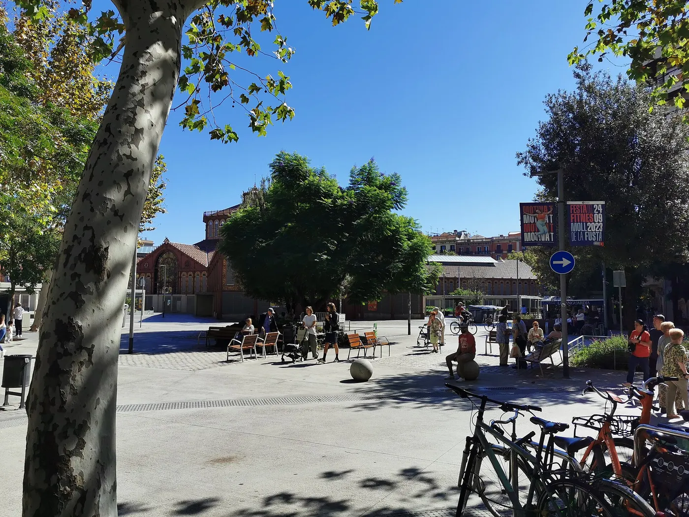
Superblocks
In the Sant Antoni superblock, measurements after the works showed NO₂ down 25% and PM10 down 17%.
Photo: Cataleirxs, Wikimedia Commons, CC BY-SA 4.0
No road deaths since 2011
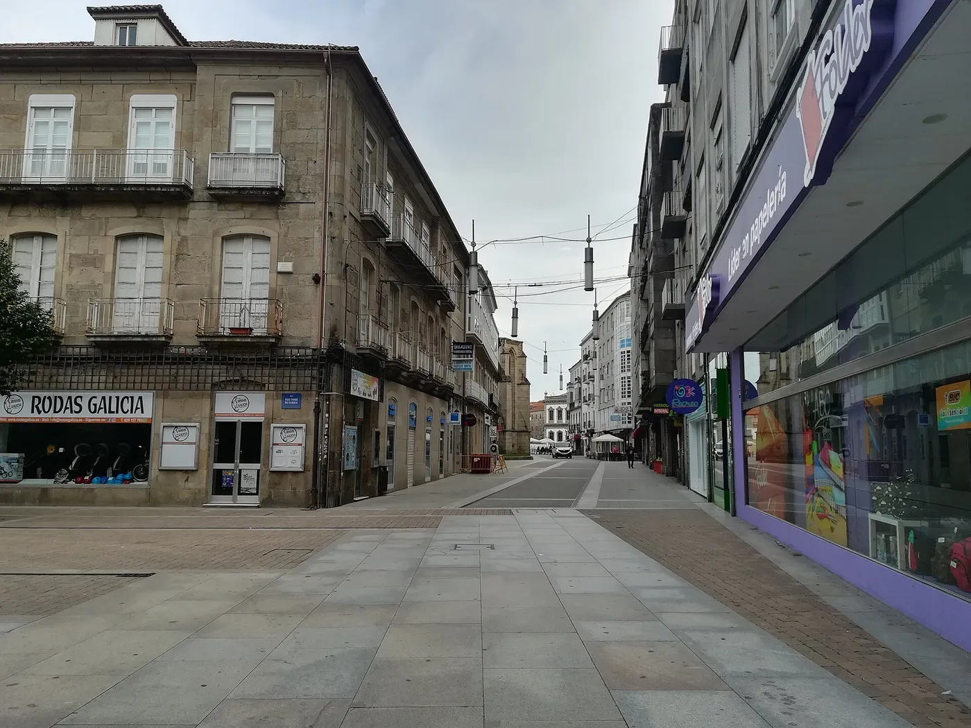
Traffic in the historic centre fell by 97%. Since 2011 nobody has been killed by a vehicle in the city — against 69 recorded pedestrian collisions in 1998.
Photo: MJSB73MP, Wikimedia Commons, CC BY-SA 4.0
One-way — except bicycles
On almost every one-way street cyclists may ride in both directions. It is just a small plate under the sign — as in the photo.
Photo: Eddie Kips, Wikimedia Commons, CC BY-SA 4.0
What changes, in numbers
| Parameter | Today | After |
|---|---|---|
| Walking along the pavement | Broken up, 0.6–1.0 m in places, blocked by cars | Continuous 1.6 m and 1.8 m on both sides |
| Pushchair, walking frame, wheelchair | Do not fit — forced into the road | Fit along the whole length of the pavement |
| Two cars meeting | Negotiated by hand, one reverses | No conflict — a single direction |
| Parking | Informal, on the pavement, uncounted | A marked 2 m bay, spaces counted |
| Speed | Limited only by obstacles | A 2.9 m lane plus 30 km/h across the area |
| Through traffic | Cutting between Makariou and Markoni | No workable route, through traffic on arterials |
| Cycling | Only in the traffic stream | Contraflow allowed, the area is connected |
Where to start
The main objection to projects like this is “expensive and slow”. The record of other cities says otherwise. In 1977 Groningen split its centre into four sectors literally overnight, using signs.2 In 2017 Ghent changed the traffic pattern on around 80 streets over a single weekend, removing or installing more than 2,500 signs.3 Rebuilding the street properly is the second step, not the first.
A realistic sequence for Agios Ioannis looks like this:
- A 6–12 month pilot. One-way signs, lane and bay markings, bollards or concrete domes instead of a kerb. An order of magnitude cheaper than construction, and reversible over a weekend if it fails.
- Measure before and after. Speeds, volumes, the number of cars parked on pavements, a residents’ survey. Without numbers the argument turns into an exchange of opinions within six months.
- The permanent phase. Raised footways at the new widths, drainage, raised crossings at junctions.
- Extend to neighbouring blocks if the pilot holds up.
You could start with a single street. Akamantos and Astiggos are good candidates: they are short, they run into arterials at both ends, and they carry almost no through traffic.
Limassol is already heading this way
None of this has to be invented from scratch — much of the same logic is already in the city’s own plans.
Limassol’s Sustainable Urban Mobility Plan (SUMP) foresees turning the old centre into a largely pedestrian area with access for buses, deliveries and residents, and converting Makariou III and Kalipoleos avenues to one-way operation.7 In May 2024 the municipality approved a 30 km/h zone in the centre, with wider pavements and planting as part of the works.8 €14.5 million from the European Recovery and Resilience Facility has been allocated to SUMP projects.
So Agios Ioannis does not need a revolution of its own. It needs the logic already adopted for the centre and for Makariou III Avenue to be carried on into the neighbourhood that adjoins that very avenue.
Sources
Department for Transport (UK), “Inclusive Mobility: A Guide to Best Practice” — 2.0 m recommended footway width, 1.5 m acceptable minimum — gov.uk (PDF).
Groningen, Verkeerscirculatieplan 1977 — Girugten.
Ghent, The Circulation Plan — the city’s official page stad.gent (six sectors, ~80 streets, 2,500 signs, ~40% through traffic).
Barcelona superblocks: NO₂ −25%, PM10 −17% in Sant Antoni — “Environmental and health effects of the Barcelona superblocks”, PMC.
Pontevedra — ClimateXChange case study (PDF), CityChangers.
Contraflow cycling on one-way streets — European Cyclists’ Federation.
Limassol Sustainable Urban Mobility Plan — Limassol Chamber of Commerce, sustainablemobility.cy.
The 30 km/h zone in central Limassol, May 2024 — Cyprus Business News.